- Site navigation:
- Pleiade Associates · Home
- Projects
- LOX Study (2013)
- PREVIOUS LOX Study (2003)
- About us...
- On The Pleiades...
- contact us
- Site map
![]()
The airport facilities would include:
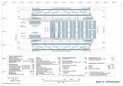
The airside facilities and operational layout of the airport are shown on Figure 13.
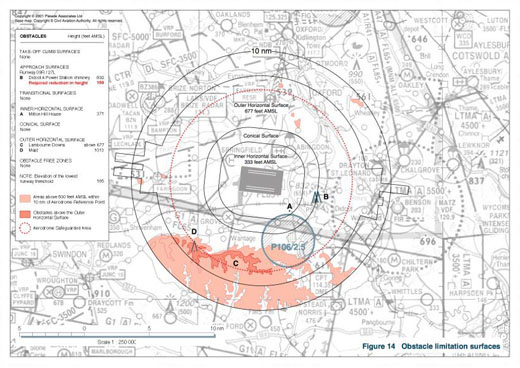
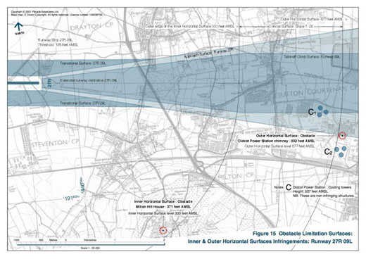
There are several physical features which are infringements of the Obstacle Limitation Surfaces. The infringements of the Inner and Outer Horizontal Surfaces [see Figure 14] are not viewed as significant to the safe operation of the airport [note 4].
These obstacles are:
Inner Horizontal Surface:
Outer Horizontal Surface
Take-off Climb Surface (runway 09R) and Appoach Surface (runway 27L)
Based on the Met Office records (1990-2000) for RAF Brize Norton and RAF Benson the runway usability for a cross-wind component of 20 knots (37 km/hour) was assessed as greater than 99.6 per cent.
Note: The International Civil Aviation Organization (ICAO) recommended minimum runway usability is 95 per cent.
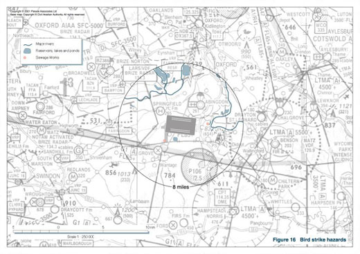
There are no significant birdstrike hazards in the vicinity of the airport site, although the potential for the build-up of hazardous levels of bird populations at the two nearby sewage works and several major rivers, reservoirs and areas of standing water within 8 miles of the airport would require continuous review. The management of the proposed airport Holding Pond would require low scale counter measures to deter colonisation by wildfowl [see Figure 16].
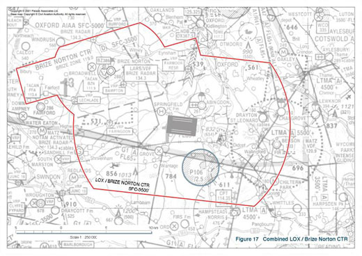
The proximity of RAF Brize Norton would require joint management of the operations from the airbase and LOX [see Figure 17]. Likewise the occasional US forces operational use of Fairford would necessitate control and coordination by the joint facility.
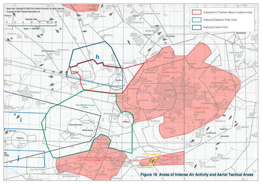
A substantial reduction in the surface extent of the Oxford AIAA would be required, with the bulk of the designation being subsumed in the Airport Control Zone [see Figure 18].
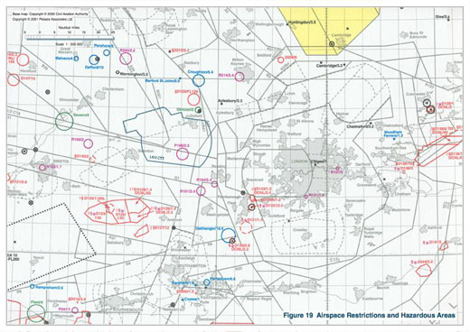
The Prohibited Area P106 around Harwell would prevent flight below 2500 feet within its extent. This would constrain recirculation of aircraft to the south of the airport to flight levels above 2500 feet. The Danger Area D129 (Brize Radar) is taken into account in the configuration of the Departure & Arrival Routes for the airport [see Figure 19].
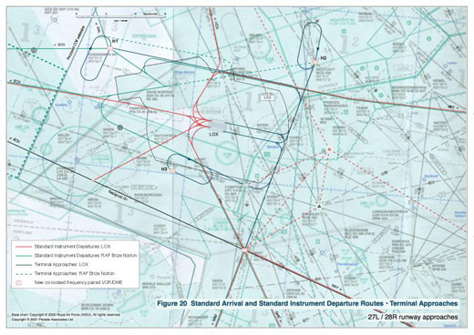
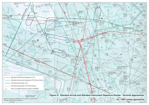
Figures 20 and 21 show the Standard Instrument Departures & Standard Terminal Arrival Routes assumed in the study – these are based on the integration of the new pattern of movement into the existing confirguration of the London system, a presumption which will need to be reviewed in the light of the future revisions and technological changes which will certainly intervene during the planning stages of the project.
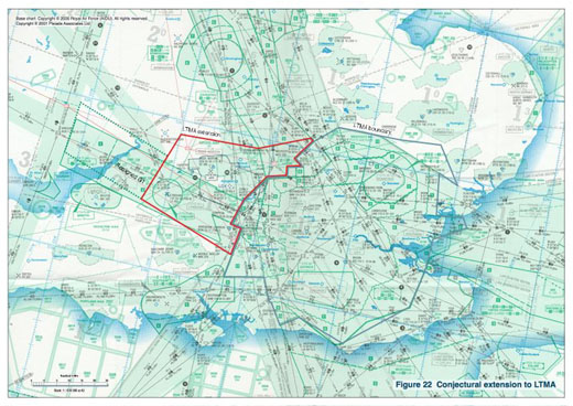
In order to accommodate the new site traffic an extension to the London Terminal Manoeuvring Area is proposed [See Figure 22].
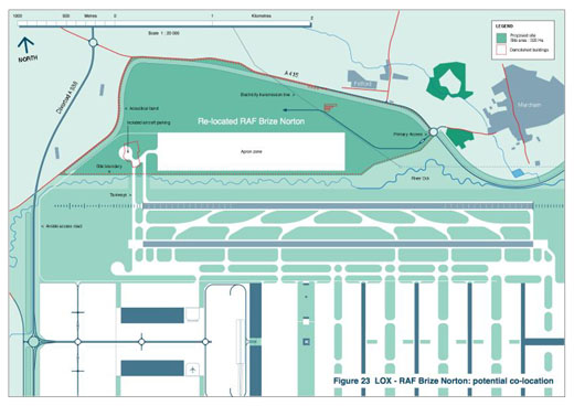
Preliminary studies were made into the feasibility of the relocation of RAF Brize Norton to an area of land adjoining the airport and enabling the shared use of the runway, airside and aircraft maintenance facilities of the airport. This co-location would offer the prospect of substantial capital release and operation savings to the Ministry of Defence. The proposal has not been developed in detail [see Figure 23].
A novel scheme for the direct compensation of those households impacted by aircraft noise is advanced in a separate document [see Appendix Figures A.13-A.14].
The Inner and Outer Horizontal Surfaces and the Conical Surfaces represent the levels above which consideration needs to be given to the removal or marking of existing objects and the control of new objects in order to facilitate practicable and efficient instrument approach procedures, and to ensure safe visual manoeuvring in the vicinity of an aerodrome.
Return
❖ The LOX Report is freely available as PDF documents here.