- Site navigation:
- Pleiade Associates · Home
- Projects
- LOX Study (2013)
- PREVIOUS LOX Study (2003)
- About us...
- On The Pleiades...
- contact us
- Site map
![]()
The construction of the airport would result in these effects:
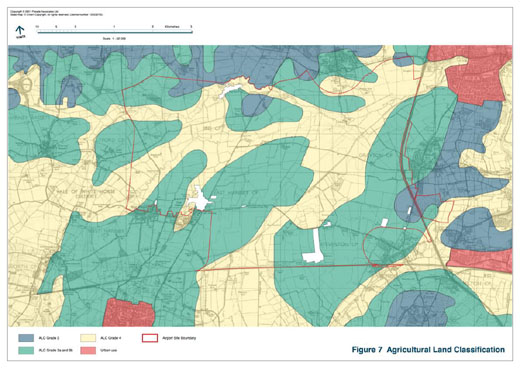
The construction of the airport would require the:
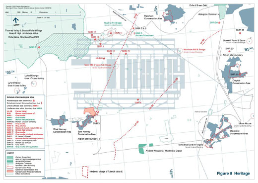
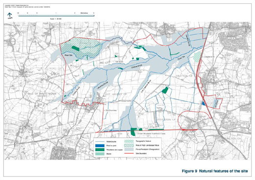
No impacts are assessed as significant and no Sites of Special Scientific Interest or other areas given statutory protection are within the airport site. The site is predominantly improved farmland with scattered small areas of coppice. However the area is drained by the River Ock and numerous small tributary watercourses – preliminary studies have demonstrated that these and their associated banks support a valuable riparian ecosystem. These habitats would be relocated and extended within the proposed Wildlife Reserves and replacement floodplains.
A part of a small area of Ancient Woodland (Hutchins's Copse) is within the site boundary: this would be retained and would be unaffected by the development.
The floodplain of the River Ock and its tributary streams occupies some 1055 Ha of the site [see Figure 9] and is designated as a Functional Floodplain by the Environment Agency (under Planning Policy Guidance 25). Flood management to eliminate the adverse effects of development would comprise:
Except for two short sections of small streams under off-site roads and acoustical bunds, no watercourses will require culverting. The airport would require extensive and significant diversions of watercourses, including a section of the River Ock.
The level of demand for water associated with the airport would substantially add to the sub-regional demand. The projected demand for water supply within the Thames Water Company area is viewed as problematic and this increased demand may be difficult to meet, even with supply and demand management and water saving technology.
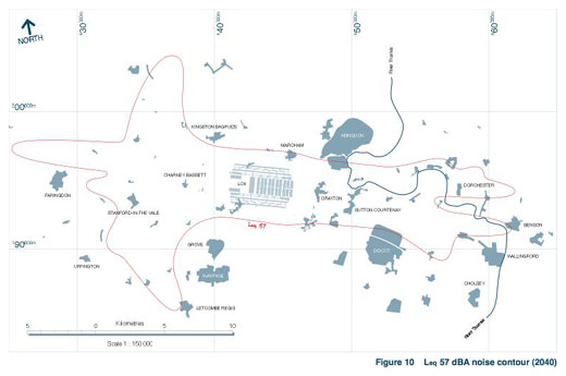
The table below shows the land areas and number of people predicted to be exposed to various levels of aircraft noise in 2040. These levels are based on an assumed operational day of 16 hours duration (07:00 – 23:00). See Figure 10.
Leq (dBA) in 2040 |
<54 |
<57 |
<60 |
<63 |
<66 |
<69 |
<72 |
|---|---|---|---|---|---|---|---|
Land area affected (km2) |
370 |
209 |
122 |
74 |
43 |
26 |
15 |
People affected ('000s) |
45 |
22 |
13 |
6 |
3 |
<1 |
0 |
Under European Union legislation, mandatory limits for airborne pollutants will apply to all airport development from 2010. The population predicted to be exposed to airborne pollutants in excess of these EU limits in 2030 is:
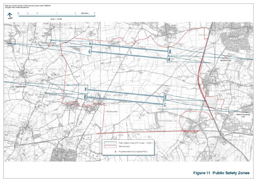
There are no impacts within the 1 in 100,000 risk contours defined for the runways. [See Figure 11]. All runways would have Runway End Safety Areas of 985 or 1000 metres in length [see Figure 11].
❖ The LOX Report is freely available as PDF documents here.